
November 13, 2025 · Spectrum GIS Team
GIS Basics: A Foundational Guide for Beginners
Welcome to the world of Geographic Information Systems (GIS)! If you’re new to spatial data, mapping technologies, or how location intelligence can transform decision-making, you’re in the right place. At Spectrum GIS So
Welcome to the world of Geographic Information Systems (GIS)! If you’re new to spatial data, mapping technologies, or how location intelligence can transform decision-making, you’re in the right place. At Spectrum GIS Solutions, we specialize in helping businesses, governments, and organizations unlock the power of GIS for real-world applications. This post is your starting point—a straightforward breakdown of the essentials. No jargon overload, just the fundamentals to get you mapping like a pro.
Whether you’re in urban planning, environmental management, or logistics, understanding GIS basics will open doors to smarter, data-driven strategies. Let’s break it down step by step.
What is GIS, Anyway?
At its core, GIS is a framework for capturing, storing, manipulating, analyzing, and displaying spatial or geographic data. Think of it as a supercharged digital map that doesn’t just show where things are, but why they matter and how they connect.
- Key Components:
Hardware: Computers, GPS devices, and scanners for data input.
- Software: Tools like ArcGIS, QGIS, or our custom platforms at Spectrum GIS for processing and visualization.
- Data: Layers of information, from satellite imagery to street addresses.
- People: Analysts and decision-makers who interpret the insights.
- Methods: Analytical techniques to overlay and query data.
Fun fact: GIS has roots in the 1960s, but today it’s powering everything from disaster response to personalized navigation apps.
Why GIS Matters in 2025
In a world flooded with location-based data (hello, IoT sensors and drones!), GIS turns chaos into clarity. Here’s why it’s a must-know:
- Efficiency Gains: Optimize routes for delivery fleets, saving time and fuel.
- Risk Mitigation: Model flood zones or wildfire spreads for proactive planning.
- Sustainability: Track deforestation or urban heat islands to promote green initiatives.
- Business Edge: Retailers use it to pinpoint ideal store locations based on demographics.
The GIS market is booming—expected to exceed $15 billion by 2026—because it’s not just about maps; it’s about informed choices.
The Building Blocks: Core Concepts
Let’s demystify the basics with simple explanations:
- Spatial Data Types:
Vector Data: Points (e.g., ATMs), lines (e.g., roads), and polygons (e.g., property boundaries). Precise and great for analysis.
- Raster Data: Grid-based pixels (e.g., satellite photos or elevation models). Ideal for continuous surfaces like temperature maps.
- Coordinate Systems:
Locations are defined by latitude/longitude or projected grids (like UTM). Pro tip: Always check your projections to avoid “map mismatches”!
- Layers and Overlays:
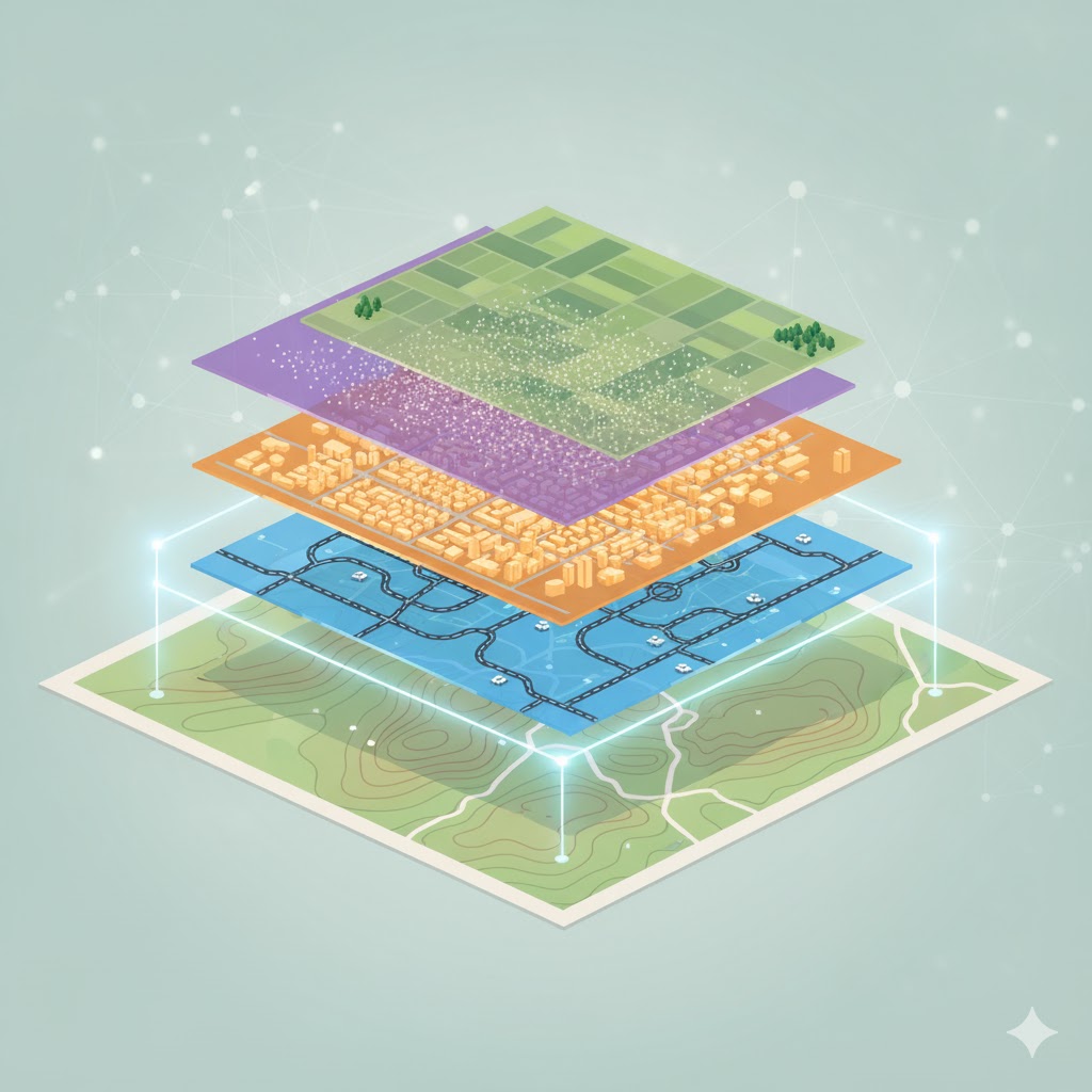
Stack data like pancakes: Add a soil layer over a land-use map to spot erosion risks. This is where GIS magic happens—revealing patterns invisible on paper.
- Basic Analysis Tools:
Buffering: Create zones around features (e.g., 500m around schools for no-build areas).
- Overlay: Combine layers to find intersections (e.g., where fertile soil meets flood-prone rivers).
- Querying: Ask questions like “Show all parks within 2km of hospitals.”
Getting Hands-On: Free Tools to Start With
No need for expensive software right away. Dive in with these beginner-friendly options:
At Spectrum GIS, we build on these foundations with custom integrations—think seamless API connections for real-time data feeds.
Common Pitfalls for Newbies (And How to Avoid Them)
- Data Overload: Start small—one layer at a time.
- Ignoring Accuracy: Validate sources; GPS can drift!
- Forgetting the ‘Why’: Always tie analysis back to a business question.
- Scalability Blind Spots: Test on small datasets before going big.
Your Next Steps with Spectrum GIS
Ready to apply these basics? Spectrum GIS Solutions offers entry-level workshops, free data audits, and tailored consulting to bridge theory and practice. Head to www.spectrumgis.co/contact for a no-obligation chat.
GIS is accessible, powerful, and endlessly fascinating. What’s your first project idea—a neighborhood map or a site suitability analysis? Share in the comments—we’re excited to hear and help!
Stay tuned for our next post: “GIS in Action—Real-World Case Studies.” Follow us for more tips!